Harvey Maps Superwalker XT25: Lake District West
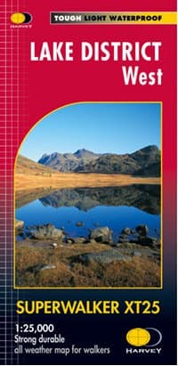
The cover of Harvey Maps Superwalker XT25: Lake District West map
Harvey Maps Superwalker XT25: Lake District West - 1:25,000

Wainwrights Covered

Below is a list of the 74 Wainwrights covered by the Harvey Maps Superwalker XT25: Lake District West map.

A list of the 74 Wainwrights (column headers with buttons are sortable)
Scafell Pike978 metres The Southern Fells
Scafell964 metres The Southern Fells
Great End910 metres The Southern Fells
Bowfell903 metres The Southern Fells
Great Gable899 metres The Western Fells
Pillar892 metres The Western Fells
Esk Pike885 metres The Southern Fells
Crinkle Crags859 metres The Southern Fells
Scoat Fell841 metres The Western Fells
Red Pike (Wasdale)826 metres The Western Fells
Steeple819 metres The Western Fells
Lingmell807 metres The Southern Fells
High Stile806 metres The Western Fells
Coniston Old Man802 metres The Southern Fells
Swirl How802 metres The Southern Fells
Kirk Fell802 metres The Western Fells
Green Gable801 metres The Western Fells
Haycock797 metres The Western Fells
Brim Fell796 metres The Southern Fells
Allen Crags785 metres The Southern Fells
Great Carrs785 metres The Southern Fells
Glaramara783 metres The Southern Fells
Dow Crag778 metres The Southern Fells
Grey Friar773 metres The Southern Fells
Wetherlam763 metres The Southern Fells
High Raise (Langdale)762 metres The Central Fells
Slight Side762 metres The Southern Fells
Red Pike (Buttermere)755 metres The Western Fells
Dale Head753 metres The North Western Fells
High Crag745 metres The Western Fells
Harrison Stickle736 metres The Central Fells
Sergeant Man736 metres The Central Fells
Ullscarf726 metres The Central Fells
Thunacar Knott723 metres The Central Fells
Brandreth715 metres The Western Fells
Pike of Stickle708 metres The Central Fells
Pike of Blisco705 metres The Southern Fells
Cold Pike701 metres The Southern Fells
Pavey Ark700 metres The Central Fells
Grey Knotts697 metres The Western Fells
Caw Fell697 metres The Western Fells
Seatallan692 metres The Western Fells
Loft Crag682 metres The Central Fells
Harter Fell (Eskdale)653 metres The Southern Fells
High Spy653 metres The North Western Fells
Rossett Pike651 metres The Southern Fells
Fleetwith Pike649 metres The Western Fells
Base Brown646 metres The Western Fells
Starling Dodd633 metres The Western Fells
Yewbarrow627 metres The Western Fells
Illgill Head609 metres The Southern Fells
Seathwaite Fell601 metres The Southern Fells
Haystacks597 metres The Western Fells
Middle Fell582 metres The Western Fells
Sergeant's Crag571 metres The Central Fells
Steel Fell553 metres The Central Fells
Rosthwaite Fell - Bessyboot551 metres The Southern Fells
Tarn Crag (Easedale)549 metres The Central Fells
Hard Knott549 metres The Southern Fells
Blea Rigg541 metres The Central Fells
Calf Crag537 metres The Central Fells
Whin Rigg537 metres The Southern Fells
Eagle Crag525 metres The Central Fells
Green Crag489 metres The Southern Fells
Armboth Fell475 metres The Central Fells
Lingmoor Fell470 metres The Southern Fells
Great Crag449 metres The Central Fells
Buckbarrow423 metres The Western Fells
Gibson Knott420 metres The Central Fells
Grange Fell417 metres The Central Fells
Helm Crag405 metres The Central Fells
Silver How395 metres The Central Fells
Black Fell323 metres The Southern Fells
Holme Fell316 metres The Southern Fells
Interactive Ordnance Survey map loading
An interactive Ordnance Survey map showing the Wainwrights covered by Harvey Maps Superwalker XT25: Lake District West